

Information in this virtual meeting room is intended to provide you with useful information and background to engage with us throughout the Oregon offshore wind commercial leasing environmental review process. We hope this information helps inform your comments and answers any questions you might have on our process.
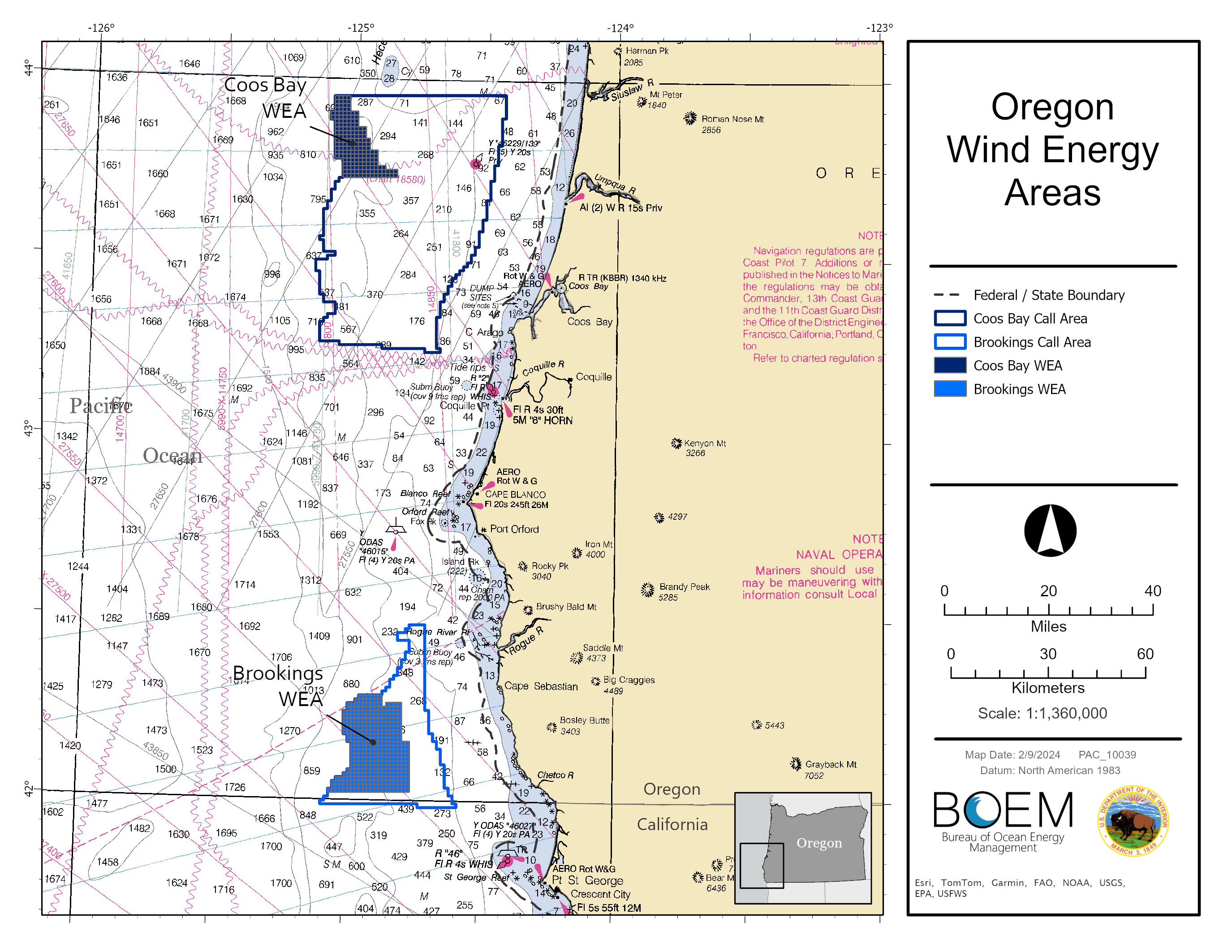
On August 13, 2024, BOEM announced the Notice of Availability for the final Environmental Assessment for Commercial Wind Lease Issuance on the Pacific Outer Continental Shelf, Offshore Oregon. The environmental assessment (EA) is part of the formal environmental review process under the National Environmental Policy Act. BOEM prepared this EA to consider the environmental consequences associated with issuing commercial wind leases in the Oregon Wind Energy Areas (WEA), and to consider associated site characterization activities (i.e., biological, archeological, geological, and geophysical surveys and core samples) and site assessment activities (i.e., installation of meteorological buoys) offshore Oregon. The Coos Bay WEA is 61,203 acres and located approximately 32 miles (mi) from shore. The Brookings WEA is 133,792 acres and approximately 18 miles off the coast.
The final and draft versions of the Environmental Assessment are available under the “Environmental Assessment” tab. This tab also contains meeting information for BOEM’s two virtual public meeting and information on comments submitted on the draft EA. Information on the scoping period and comments submitted during scoping are available under the “Scoping” tab.
The following documents are available for your viewing:
- Federal Register : Notice of Availability of a Final Environmental Assessment for Commercial Wind Lease Issuance on the Pacific Outer Continental Shelf, Oregon (August 2024)
- Final Environmental Assessment and Finding of No Significant Impact (August 2024)
- Draft Oregon Section 106 Programmatic Agreement
- Finding of No Historic Properties Affected for the Issuance of a Commercial Lease for Coos Bay and Brookings Wind Energy Areas on the Outer Continental Shelf Offshore Oregon
- Comment Period Extended on Draft Environmental Assessment on Oregon Offshore Wind Leasing Activities (May 30, 2024)
- Interior Department Proposes Offshore Wind Sales in Oregon, Gulf of Maine (Press Release 04/30/2024)
- Notice of Availability of Draft EA
- Draft Environmental Assessment
- Notice of Intent to Prepare an EA
- BOEM Finalizes Wind Energy Areas in Oregon (Press Release 02/13/2024)
More information is available on the Oregon Activities page.
FINAL EA (August 2024)
Oregon Leasing Final Environmental Assessment and Appendices and Finding of No Significant Impact: Environmental Assessment for Commercial Wind Lease Issuance on the Pacific Outer Continental Shelf, Offshore Oregon
DRAFT EA (April 2024)
Public comment period is closed: Oregon Draft Environmental Assessment and Appendices: Environmental Assessment for Commercial Wind Lease Issuance on the Pacific Outer Continental Shelf, Oregon. Comments are available at Regulations.gov under Docket No. BOEM-2023-0065.
The following documents are available for your viewing:
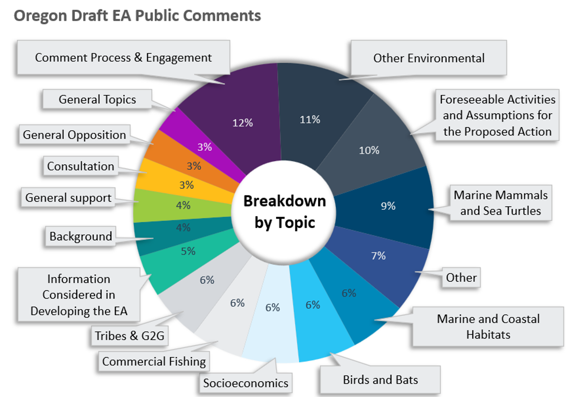
- High-Level Summary of Draft EA Comments (August 2024)
- The detailed report of comments and BOEM’s response to comments is available in Appendix B of the Final EA (Vol II)
In addition to this virtual meeting room, BOEM hosted two virtual meeting sessions to share information about BOEM’s environmental analysis and to solicit public input on the Oregon Wind Energy Area (WEA) draft Environmental Assessment (EA). Each meeting was recorded and is posted below. All comments and questions received during the meeting are part of the public record.
Tuesday, May 21, 2024
1:00 pm (Pacific Time)
Wednesday, June 5, 2024
4:00 pm (Pacific Time)
On February 14, 2024, the Bureau of Ocean Energy Management (BOEM) announced a Notice of Intent (NOI) to prepare an Environmental Assessment (EA) under the National Environmental Policy Act (NEPA), to analyze potential impacts of possible wind energy-related leasing, site assessment, and site characterization on the U.S. Pacific Outer Continental Shelf (OCS) off the coast of Oregon.
As part of this scoping process, BOEM asked stakeholders, organizations, Federal agencies, and Tribal, State, and local governments to submit comments on the scope of the EA, including environmental issues and the identification of reasonable alternatives that should be considered in the EA. The environmental impacts of any proposed wind energy projects will be assessed after a lease is issued and before BOEM decides whether or not to approve any lessee’s project construction and operations plan. The public comment period for scoping ended on March 15, 2024. Comments are available at regulations.gov under Docket No. BOEM-2023-0065.
The following documents are available for your viewing:
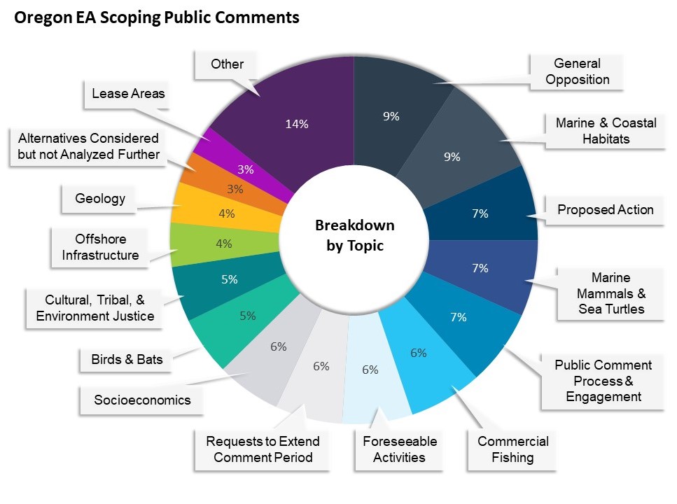
- High-Level Summary of Oregon Scoping Comments (April 2024)
- Detailed Report of Oregon Scoping Comments (April 2024)
- Information about the Environmental Assessment process, what scoping is, and the type of comments BOEM requested is available in the Scoping for Oregon Environmental Assessment presentation slides (February 2024)
- Frequently Asked Questions
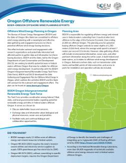
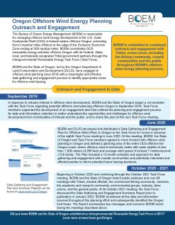
BOEM and the State, led by the Oregon Department of Land Conservation and Development (DLCD), have engaged in offshore wind planning with a meaningful and effective data gathering and engagement process to inform the identification of Oregon Call Area(s) appropriate for offshore wind leasing. The Data Gathering and Engagement Plan for Offshore Wind Energy in Oregon outlines how BOEM and the State are conducting the planning process. The Data Gathering and Engagement Summary Report outlines the outcome of BOEM’s and DLCD’s engagement through 2021 with research organizations and potentially interested and affected parties in gathering data and information to inform potential offshore wind energy leasing decisions offshore Oregon.
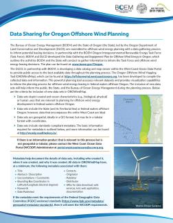
The Oregon Department of Land Conservation and Development (DLCD), in partnership with BOEM, developed the Oregon Offshore Wind Mapping Tool (OROWindMap) within the West Coast Ocean Data Portal to provide public access to the best available data throughout the planning process. This planning tool accesses relevant datasets and provides visualization capabilities to inform the planning process for offshore wind energy leasing in federal waters offshore Oregon. The OROWindMap Catalog documents the data records incorporated into OROWindMap. The inclusion of new data sets will help inform the public, the State, and BOEM during the planning process. More information on how to include data in OROWindMap.
More information on BOEM-Oregon offshore wind planning efforts can be found on the Oregon Offshore Renewable Energy factsheet and on the BOEM Oregon Intergovernmental Renewable Energy Task Force and BOEM and State of Oregon Participation in Standing Meetings webpages.
Related Announcements
- Web Story - BOEM Offers First Renewable Energy Research Lease in Federal Offshore Waters Along the U.S. West Coast (01/19/2021)
Call for Information and Nominations
Oregon Call for Information and Nominations
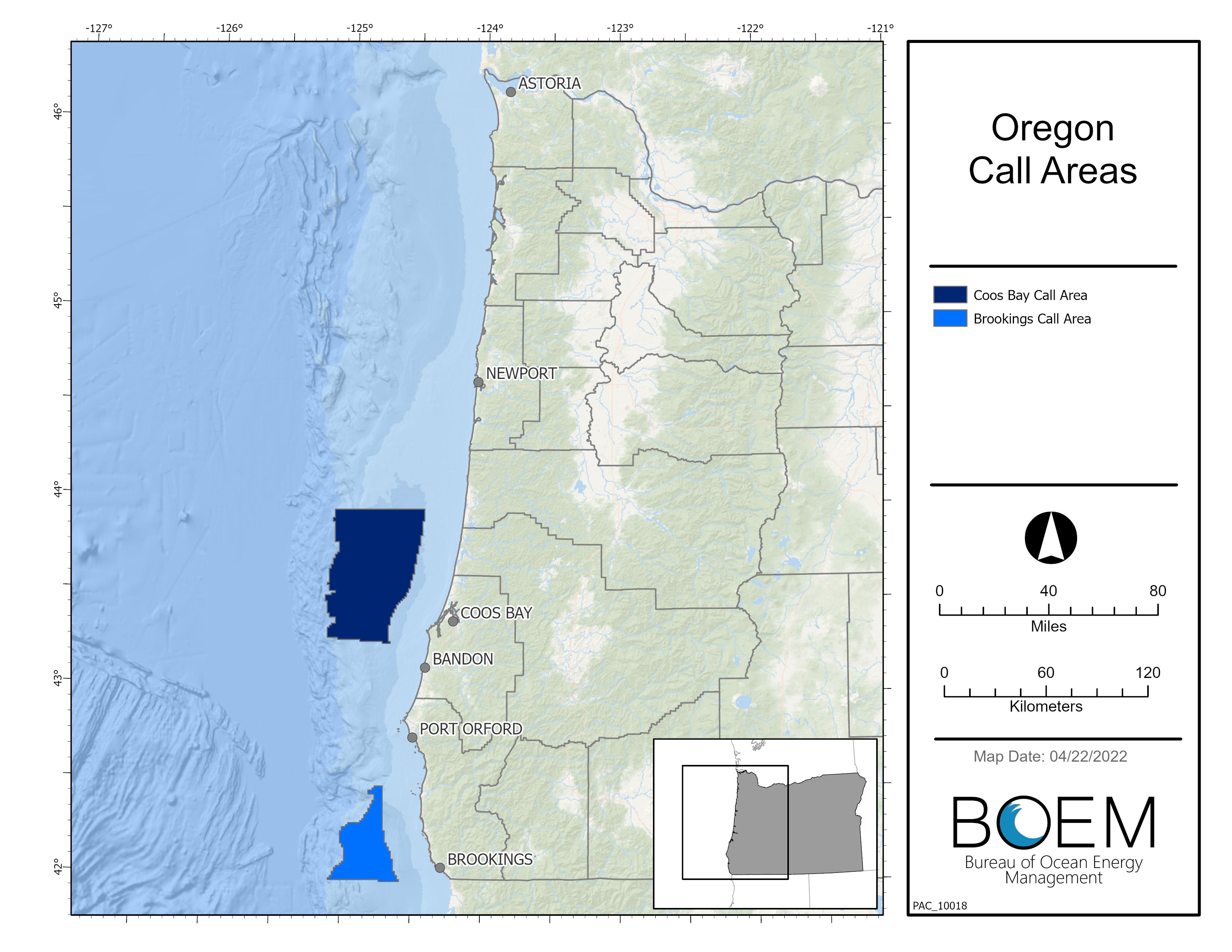
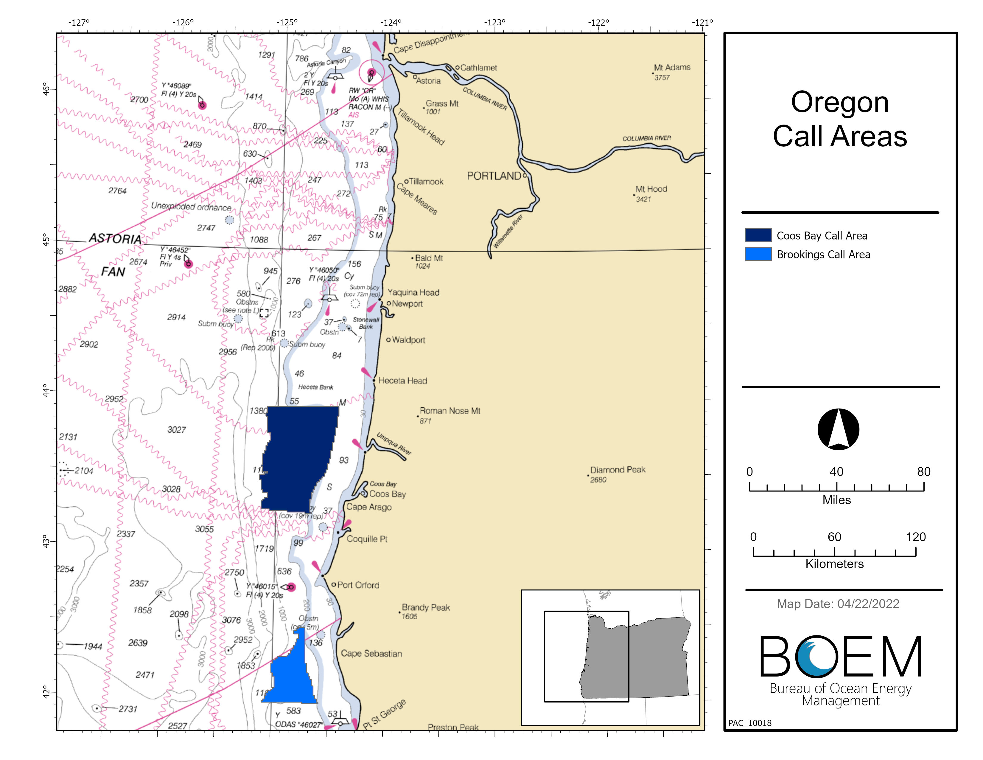
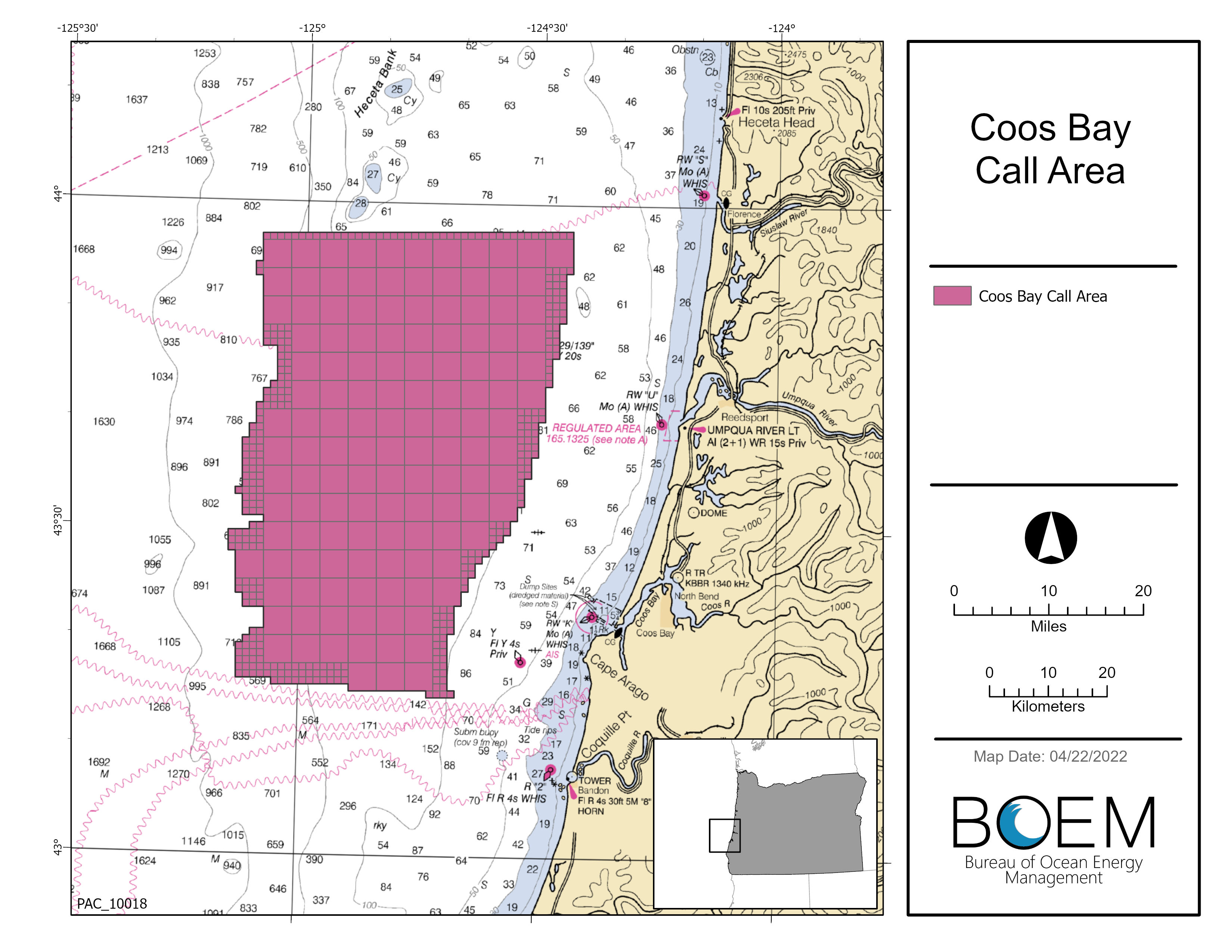
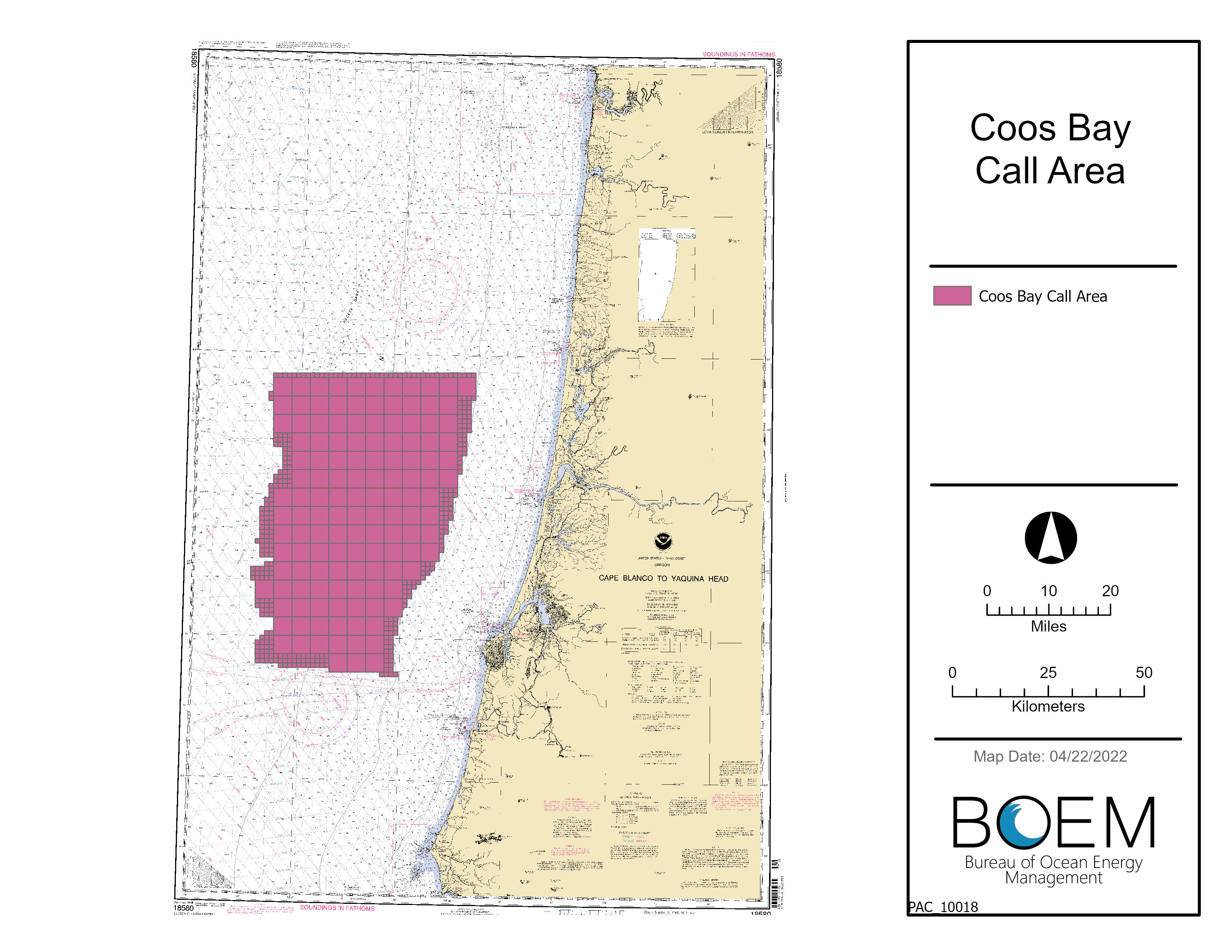
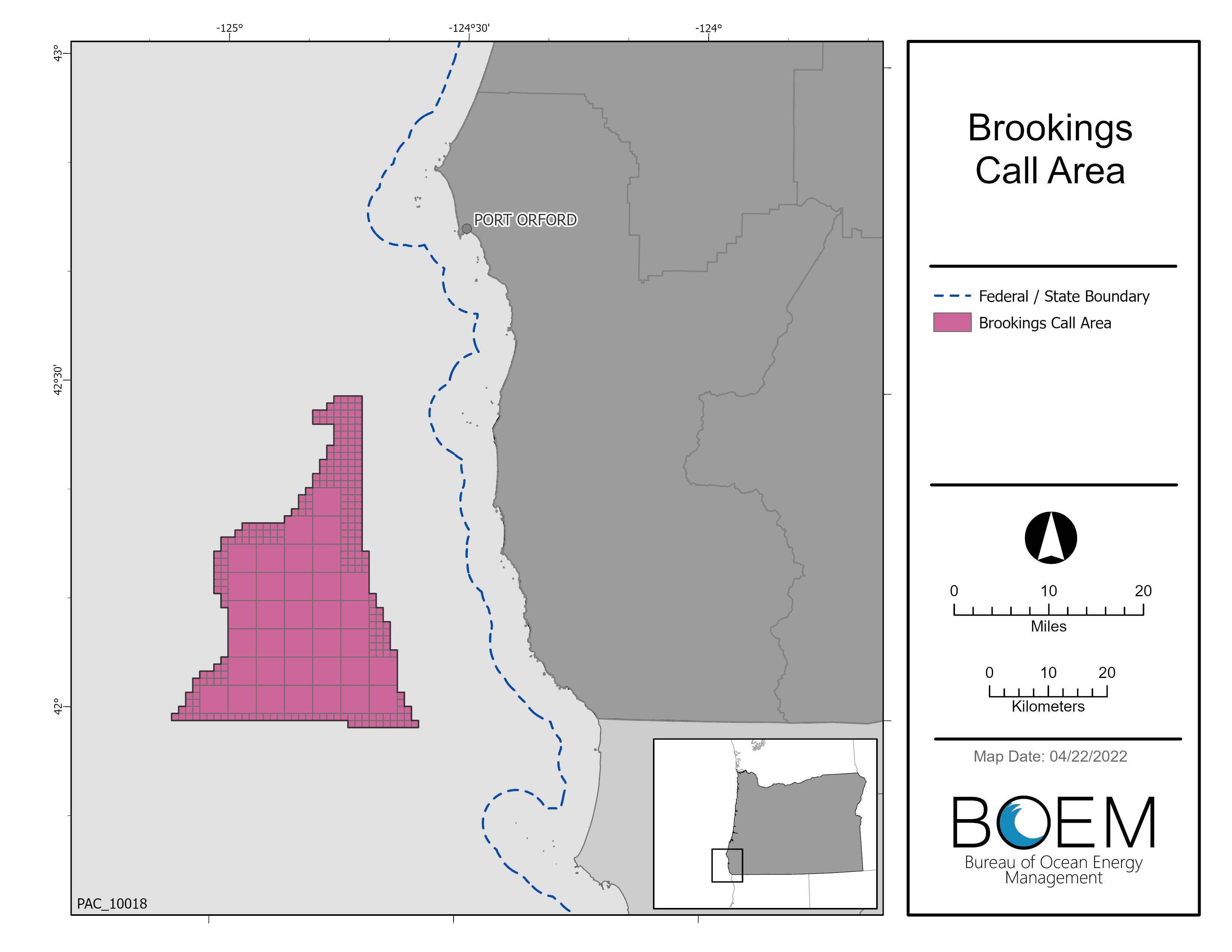
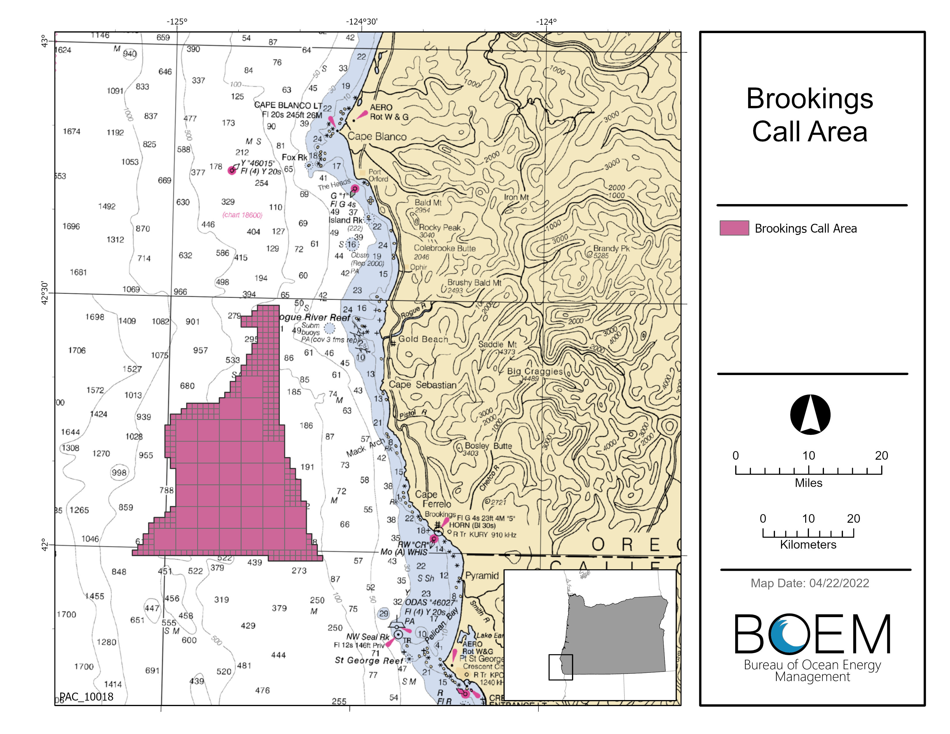
The Call Area is located offshore the State of Oregon and comprises areas identified as Coos Bay and Brookings. These two areas total about 1,159,298 acres (1,811 square miles) and are located offshore south-central and southern Oregon, respectively.
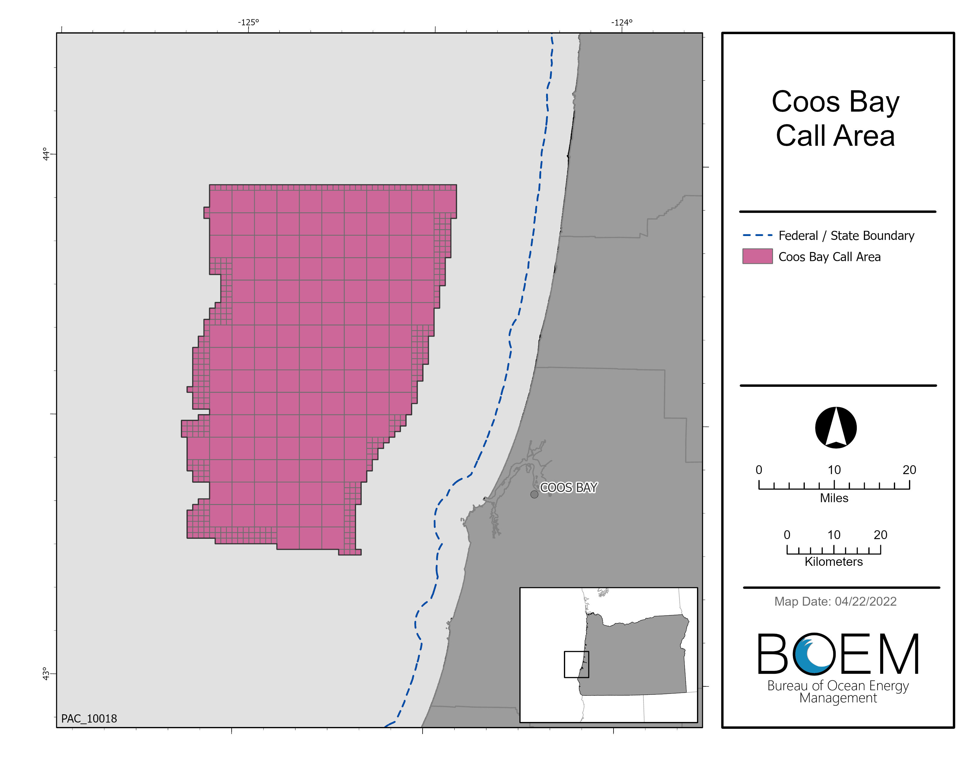
- Coos Bay Call Area: The boundary of the Coos Bay Call Area begins 13.8 miles offshore Charleston, Oregon, and extends to about 65 miles offshore. The eastern boundary water depth ranges from about 394 to 722 feet (120 to 220 meters). The area is about 67 miles in length from north to south and about 41 miles in width from east to west. The entire area is approximately 872,854 acres (1,364 square miles).
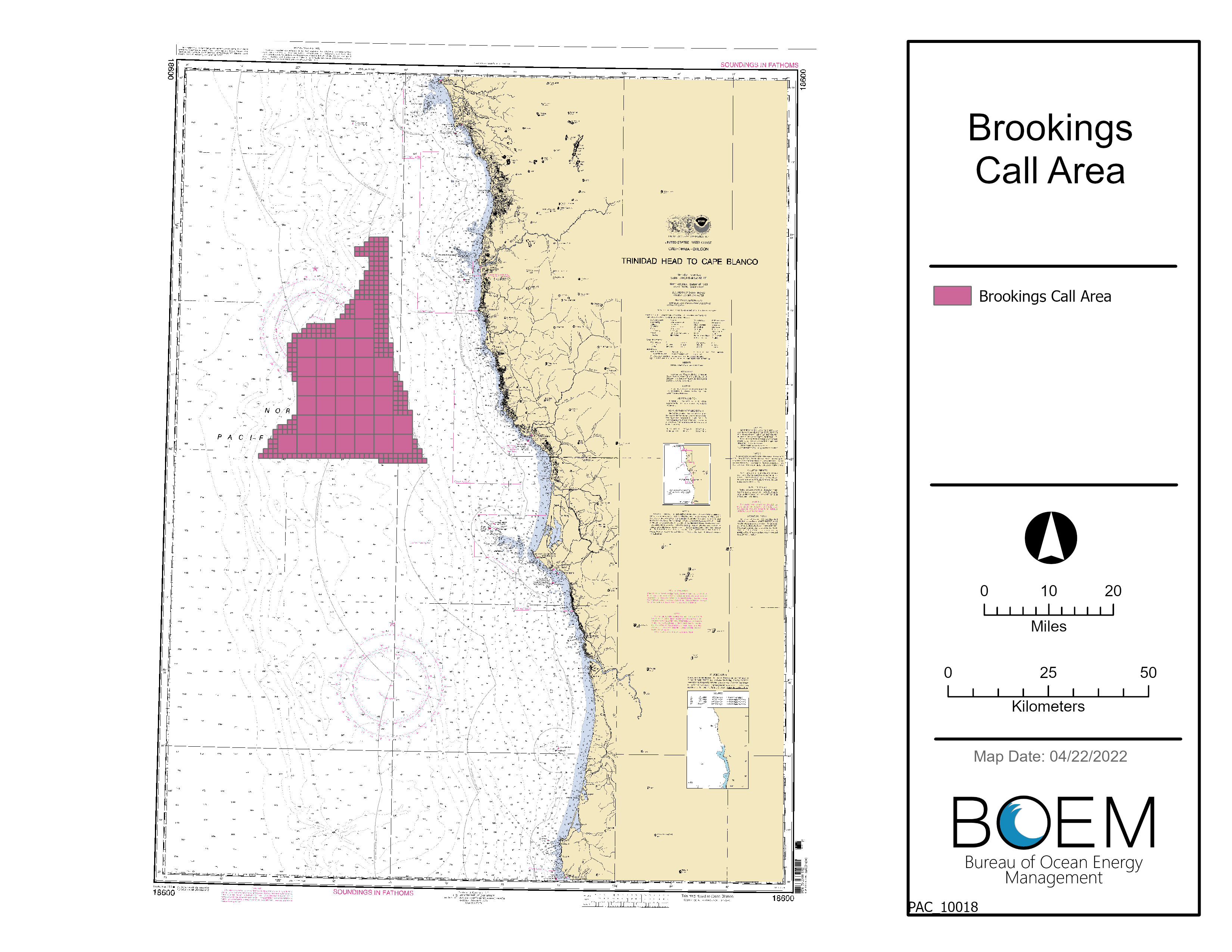
- Brookings Call Area: The boundary of the Brookings Call area begins 13.8 miles offshore Gold Beach and Brookings, Oregon, and extends to about 46 miles offshore. The eastern boundary water depth ranges from about 410 to 1,115 feet (125 to 340 meters). The area is about 46 miles in length from north to south and about 22 miles in width from east to west. The entire area is approximately 286,444 acres (448 square miles).
Maps of Oregon Call Areas
- Oregon Call Areas Map, (NOAA Chart), (Shapefile) and Waypoints (Excel, Shapefile)
In response to the Call, BOEM received nominations of areas of interest from 4 developers. Each of the parties listed below has been legally, technically and financially qualified.
- Map of all Nominations Received
- Avangrid Renewables LLC
- BlueFloat Energy Oregon LLC
- OW North America Ventures LLC
- US Mainstream Renewable Power Inc
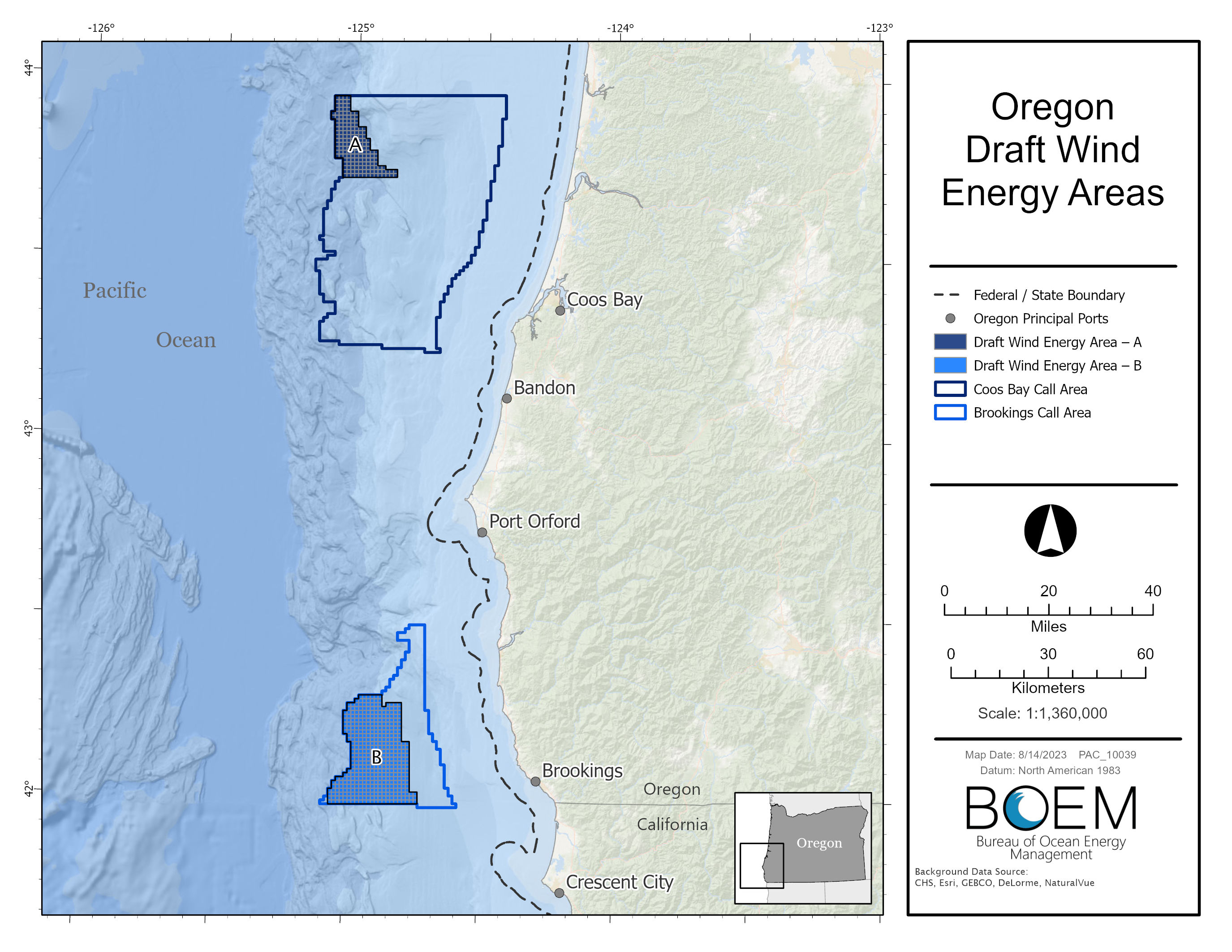
Draft Wind Energy Areas
On Aug.15, 2023, BOEM announced a 60-day public comment period on two draft Wind Energy Areas (WEAs) located in the existing Call Areas offshore southern Oregon. The draft WEAs cover approximately 219,568 acres offshore southern Oregon with their closest points ranging from approximately 18 – 32 miles off the coast.
BOEM used a comprehensive process to identify the draft WEAs as potential offshore locations that appear most suitable for floating offshore wind energy leasing and potential development, taking into consideration possible effects to local coastal and marine resources and ocean users. In addition to coordinating with the State of Oregon, BOEM collaborated with the National Oceanic and Atmospheric Administration’s National Centers for Coastal Ocean Science (NCCOS) to use an ocean planning model that seeks to identify and minimize conflicts.
- Final NCCOS Report: A Wind Energy Area Siting Analysis for the Oregon Call Areas (Feb. 2024)
- Draft NCCOS Report: A Wind Energy Area Siting Analysis for the Oregon Call Areas (Aug. 2023)
During the comment period, BOEM held an intergovernmental renewable energy task force meeting, an informational fishing webinar and in-person public meetings on the Oregon coast to discuss data used to inform the draft wind energy areas and next steps.
Virtual Oregon Intergovernmental Renewable Energy Task Force Meeting
Informational Fishing Webinar (fishing data focus):
- Agenda
- Thursday, September 21, 2023: 5:00 pm – 8:00 p.m.
In-person public open house meetings:
- VENUE CHANGE - Gold Beach, Oregon: Tuesday, September 26, 2023
Gold Beach Community Center
29841 Airport Way
4:00p.m. – 8:00 p.m.
- Coos Bay, Oregon: Wednesday, September 27, 2023
Coos Bay Public Library, Myrtlewood Room
525 Anderson Avenue
4:00p.m. – 8:00 p.m.
- Brookings, Oregon: Thursday, September 28, 2023
Southwest Oregon Community College - Curry Campus, Commons Room
96082 Lone Ranch Pkwy
4:00p.m. – 8:00 p.m.
BOEM accepted public comments at the in-person open house and virtual meetings. Comments received during the comment period informed designation of final WEAs for further analysis and review for possible offshore wind energy leasing. BOEM extended the comment period through 11:59 pm ET on October 31, 2023. To view comments on the draft WEAs please go to regulations.gov, docket number BOEM-2023-0033.
Draft Wind Energy Area Public Meeting Handouts
- BOEM Outreach Engagement fact sheet
- BOEM Visualization fact sheet
- NOAA NCCOS Fisheries Handout
- NOAA NCCOS Natural Resources Handout
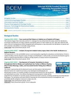
- Selected BOEM Research Informing Oregon Renewable Energy
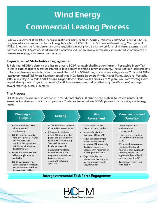
- Wind Energy Commercial Leasing Process
Maps
- Oregon Draft WEAs
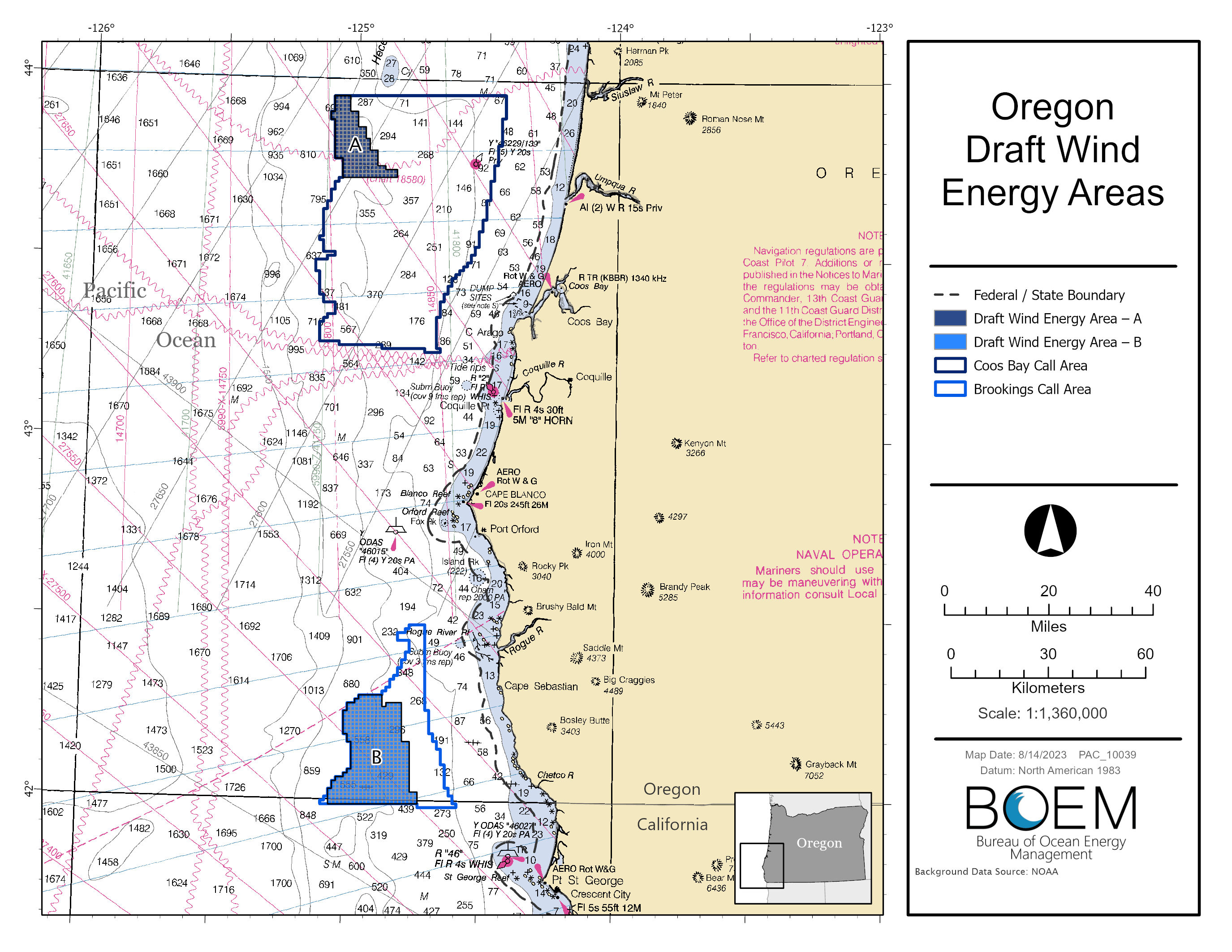
- Oregon Draft WEAs Nautical Chart Map
- Oregon Draft WEAs Coordinates Map (hyperlink to attached map)
- Shapefiles
News Release: BOEM Finalizes Wind Energy Areas in Oregon
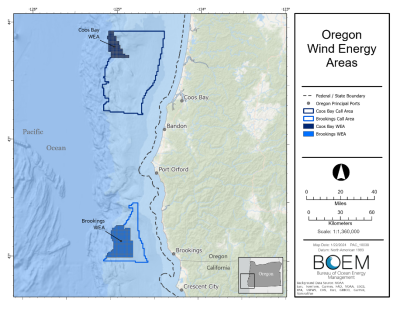
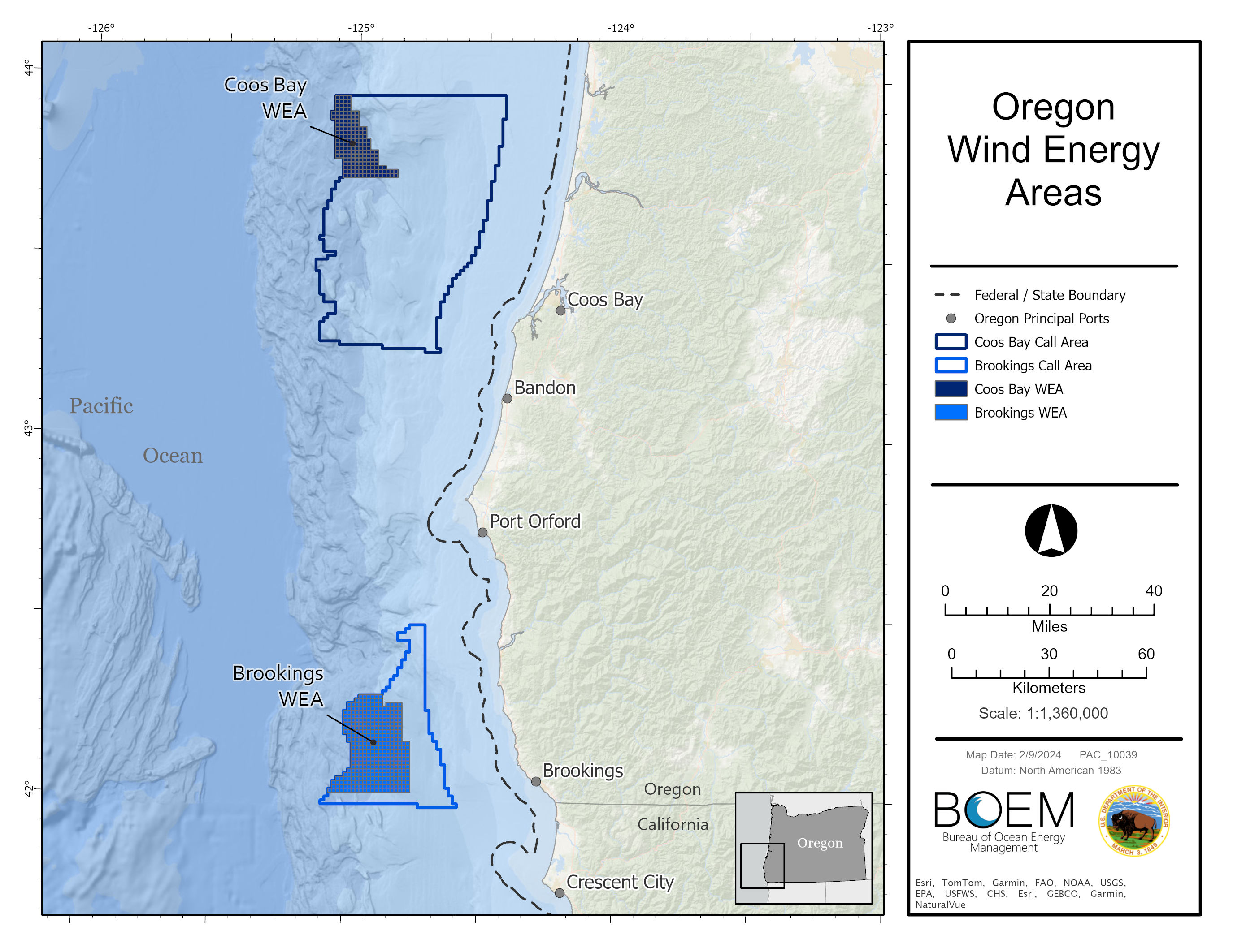
Oregon Wind Energy Areas
The proposed Brookings Wind Energy Area consists of 133,792 acres and is located approximately 18 miles from shore. The proposed Coos Bay Wind Energy Area consists of 61,203 acres and is located approximately 32 miles from shore. The Brookings WEA is 133,792 acres and approximately 18 mi off the coast. If fully developed, the Final WEAs could support 2.4 GW of energy production.
BOEM used a comprehensive process to identify the potential offshore locations that appear most suitable for floating offshore wind energy leasing and potential development, taking into consideration possible impacts to local coastal and marine resources and ocean users. BOEM coordinated with the State of Oregon and collaborated with the National Oceanic and Atmospheric Administration’s National Centers for Coastal Ocean Science (NCCOS) to use an ocean planning model that seeks to identify and minimize conflicts.
- Oregon Wind Energy Area Identification Memo
- Notice of Intent to prepare an Environmental Assessment for commercial wind lease issuance and site assessment activities on the Pacific Outer Continental Shelf Offshore Oregon – How to comment on the scoping period
Maps