
MarineCadastre.gov is marking its 15th year as an authoritative source for marine and coastal maps and information to support a wide array of ocean users and regulators by adding new and updated data and services.
The tool was developed in a cooperative effort between BOEM and NOAA as an online, interactive map viewer that integrates coastal, oceans, and great lakes information in a common reference framework. The information consists of legal, property ownership (cadastre), physical, biological, ocean uses, and cultural information from multiple agencies.
Users include coastal and offshore resource management agency staff, state governments, regional and state portals that pull from MarineCadastre.gov, educators, offshore industry, NGOs, and any other stakeholder that is interested or concerned about activities and plans on our Nation’s Outer Continental Shelf.
Data are used by citizens for commenting to governments, by planners for environmental analysis, intergovernmental planning, maps and visuals at various meetings, press briefings, and general information and outreach. The project is often used within academic curriculums to teach students about GIS and Marine Spatial Planning in U.S. waters.
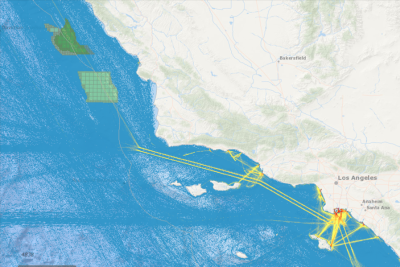
A growth area for the tool has been including vessel transit counts using data from the Automatic Identification Systems (AISs) that mariners provide to the U.S. Coast Guard. To serve growing interest in this data, the MarineCadastre team will offer a new portal in 2022 called AccessAIS. This tool will enable users to interactively download U.S. vessel traffic data across user-defined geographies and time periods. It also provides quick visualization of vessel traffic densities and patterns using underlying map services derived from the same point data that are available for download via the application. During 2021, the MarineCadastre team updated 24 web services showing such things as Blue Whale Pacific densities in summer and fall, ocean dump sites, offshore oil and gas platforms and wells, and many more. The team also developed 28 data sets for MarineCadastre applications.
-- BOEM --
The Department of the Interior’s Bureau of Ocean Energy Management (BOEM) is responsible for America’s offshore energy and mineral resources. The bureau promotes energy independence, environmental protection and economic development through responsible, science-based management of energy and mineral resources on the U.S. Outer Continental Shelf.