
BOEM’s OASIS study is investigating underwater mudslides on the Mississippi River Delta Front to better understand their causes, frequency, and risks. By mapping the seafloor and tracking shipwreck movement, researchers aim to protect offshore infrastructure, marine habitats, and historic sites.
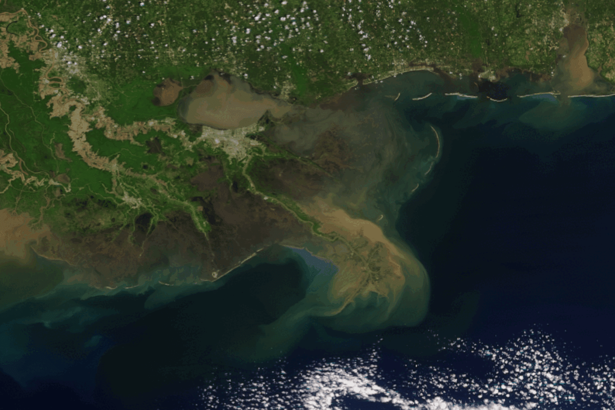
To better understand these events, BOEM and its partners launched the Offshore Analysis of Seafloor Instability and Sediments (OASIS) study. This major research effort focuses on uncovering how and why underwater mudslides occur, how frequently they happen, and how they impact both natural and human-made features on the Delta Front.
Underwater mudslides, triggered by storms, hurricanes, or seismic activity, can move vast amounts of sediment at high speed. Yet scientists still lack critical data about their behavior. The OASIS study aims to close these gaps using innovative methods. Researchers are remapping the Delta Front for the first time in decades, collecting sediment cores, and applying machine learning to identify high-risk areas.
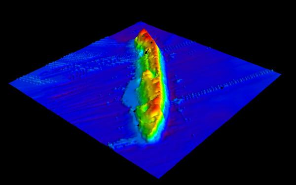
One of the study’s most unique approaches involves using historic shipwrecks as seafloor markers. By tracking their movement over time, scientists can detect past mudslide activity and better predict future events.
Findings from the OASIS study will help protect offshore infrastructure, preserve historic shipwrecks, and guide future energy development. Scheduled for completion in 2027, the study represents a major step toward understanding one of the ocean’s most powerful and least understood forces. Read more about Understanding Underwater Mudslides.
Studies Across America
The study is featured in BOEM’s new Studies Across America StoryMap, an interactive online narrative highlighting the bureau’s research and environmental assessment efforts, which BOEM launched to help commemorate America’s 250th birthday.

-- BOEM --
The Department of the Interior’s Bureau of Ocean Energy Management (BOEM) manages development of U.S. Outer Continental Shelf (OCS) energy, mineral, and geological resources in an environmentally and economically responsible way.