
The waters around the Aleutian Islands are virtually unexplored territory. And for good reason.
Located in the Pacific Ocean near Alaska, these waters are famous for their violent storms and high winds that can make ocean travel too dangerous for the average sea vessel.
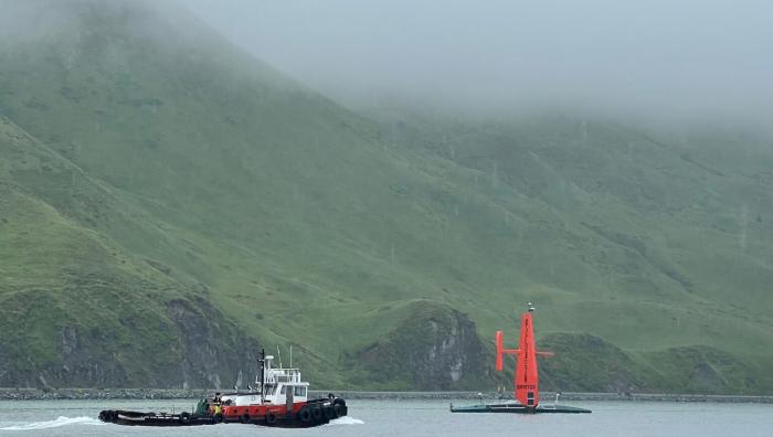
Enter a most unconventional sea vessel, the Saildrone Surveyor.
|
|
Saildrone Surveyor is uniquely suited to reach and map our most unexplored oceans. Because it requires no crew, it can stay out for months at a time. Saildrone’s fleet of uncrewed surface vehicles are navigated from point to point using modern GPS systems, always monitored by a remote pilot who can instantly take over the controls to better serve the mission or protect vessel safety.
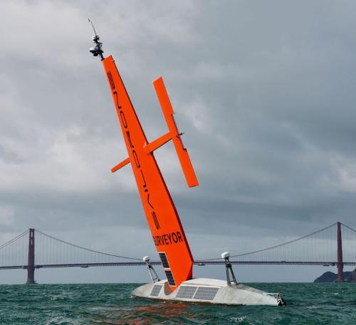
In addition, the Saildrone Surveyor is built more like a futuristic seagoing tank than a typical seacraft. Powered partly by solar panels, its hull is protected by a stainless steel and carbon fiber design impervious to wind and waves. And its wing acts like a sail to help propel it through even the roughest seas. It also has a failsafe diesel engine as fallback.
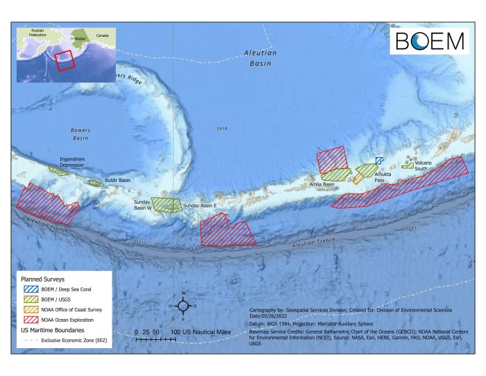
For its first funded expedition in July 2022, BOEM partnered with the National Oceanic and Atmospheric Administration (NOAA) and its Ocean Exploration Cooperative Institute partners to launch Saildrone Surveyor on a 2,000-mile trip from Alameda, California, to Dutch Harbor, Alaska in the Aleutian Islands chain. From the operational base of Dutch Harbor, Saildrone Surveyor explored the nearby waters to gather data on one of the least-mapped regions in the world.
During its tour, Saildrone Surveyor studied the waters and seafloor around the Islands of Four Mountains and the coasts of Seguam, Atka, and Herbert Islands and was able to gather data efficiently and quickly in all of these largely unexplored areas.
Eager to prove its mettle during its travels, Saildrone Surveyor successfully navigated winds up to 35 knots, braved swells nearly two stories in height, and even dodged Typhoon Merbok, which ferociously charged it before the remote vessel was diverted to safely study a secondary location.
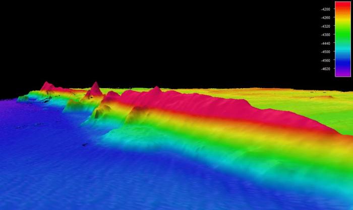
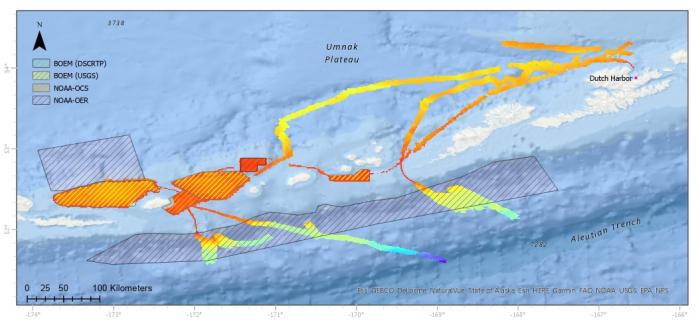
Saildrone Surveyor spent 52 days between August and September of 2022 mapping 6,276 square miles of unexplored sea floor, an average of 120 square miles per day. Saildrone Surveyor’s high-resolution mapping sonars provided unprecedented, detailed views of the seafloor, with preliminary indications suggesting potential presence of hydrothermal vents in the region.
|
|
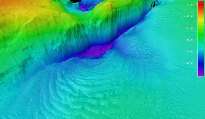
Upon its return from Alaska, Saildrone Surveyor was then sent on the second leg of the expedition (not funded by BOEM), mapping another 8,665 square miles off the California coast. There its sensors detected a previously unknown seamount jutting over one-half mile off the seafloor. This discovery will help inform our understanding of the ocean’s physical processes, and a closer examination of its biological makeup of this habitat is in order.
With the information gained from the Saildrone Surveyor expedition, further exploration is being planned. This summer, NOAA will send the exploratory vessel Okeanos Explorer into Alaskan waters to continue filling additional gaps in seafloor mapping from the ship, using its remotely operated vehicles to closely examine areas of interest identified during the Saildrone Surveyor voyage.
Additional future partnerships are also under development to use Saildrone and other uncrewed vehicles to explore more areas previously considered unreachable by human-piloted vessels – and boldly go where no ocean drone has gone before.
For more about BOEM, please visit https://www.boem.gov/environmental-studies.
|
|
-- BOEM --
The Department of the Interior’s Bureau of Ocean Energy Management (BOEM) is responsible for America’s offshore energy and mineral resources. The bureau promotes energy independence, environmental protection and economic development through responsible, science-based management of energy and mineral resources on the U.S. Outer Continental Shelf.