
Developers of energy and other ocean-based projects have a new, readily accessible tool that may help them get to know many facets of a proposed location long before they take costly steps related to selecting sites.
The tool is OceanReports, and its use is explained in the first 30 minutes of a one-hour, how-to webinar available on BOEM’s website.
BOEM and the National Oceanic and Atmospheric Administration (NOAA) developed OceanReports, which allows agencies to “modernize the acquisition, distribution, and use of the best available ocean-related science and knowledge” as called for in President Trump’s Executive Order 13804, Ocean Policy to Advance the Economic, Security and Environmental Interests of the United States.
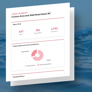
OceanReports is an online resource that produces infographics for any area of the U.S. Outer Continental Shelf the user wants to learn about. These graphics are generally available in six topic areas: general information, energy and minerals, natural resources and conservation, oceanographic and biophysical, transportation and infrastructure, and economics and commerce.
The information is generated on offshore wind potential, wind planning areas, current wind leases nearby, oil and gas potential, current oil and gas leases in the area, and electric power stations near the coast. Information from the other topic areas reveals what features predominate on the surface through the ocean column to the seabed in the same accessible format.
The webinar is a recording of one delivered live stakeholders all over the U.S. and the world during an Ecosystem Based Management Tools webinar on July 28. It’s posted with other mapping resources on BOEM.gov.
For more information, visit OceanReports.