
One of the ocean’s most remote frontiers may hold clues not only to Earth’s geological history—but also to America’s energy future.
Critical minerals are essential to modern life, powering everything from smartphones to renewable energy technologies. Before any offshore development can move forward, however, scientists must understand where these resources are located and how to protect the ecosystems surrounding them.
The Bureau of Ocean Energy Management (BOEM) oversees energy, mineral, and geological resources on the U.S. Outer Continental Shelf (OCS). As part of its mission to ensure environmentally and economically responsible management, BOEM prioritizes offshore areas likely to contain critical minerals. These areas require detailed mapping and exploration to safeguard marine habitats and historic resources.
Exploring the Aleutian Arc

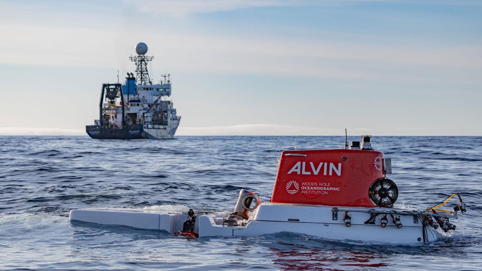
Despite spanning more than 1 million square kilometers, only about 38 percent of Alaska’s seafloor had been mapped as of early 2025—and far less has been closely studied. To help close that gap, BOEM joined a team of ocean scientists from June 15 to July 2, 2025, aboard the research vessel R/V Atlantis to explore the remote Aleutian Arc, a volcanic island chain extending into the North Pacific.
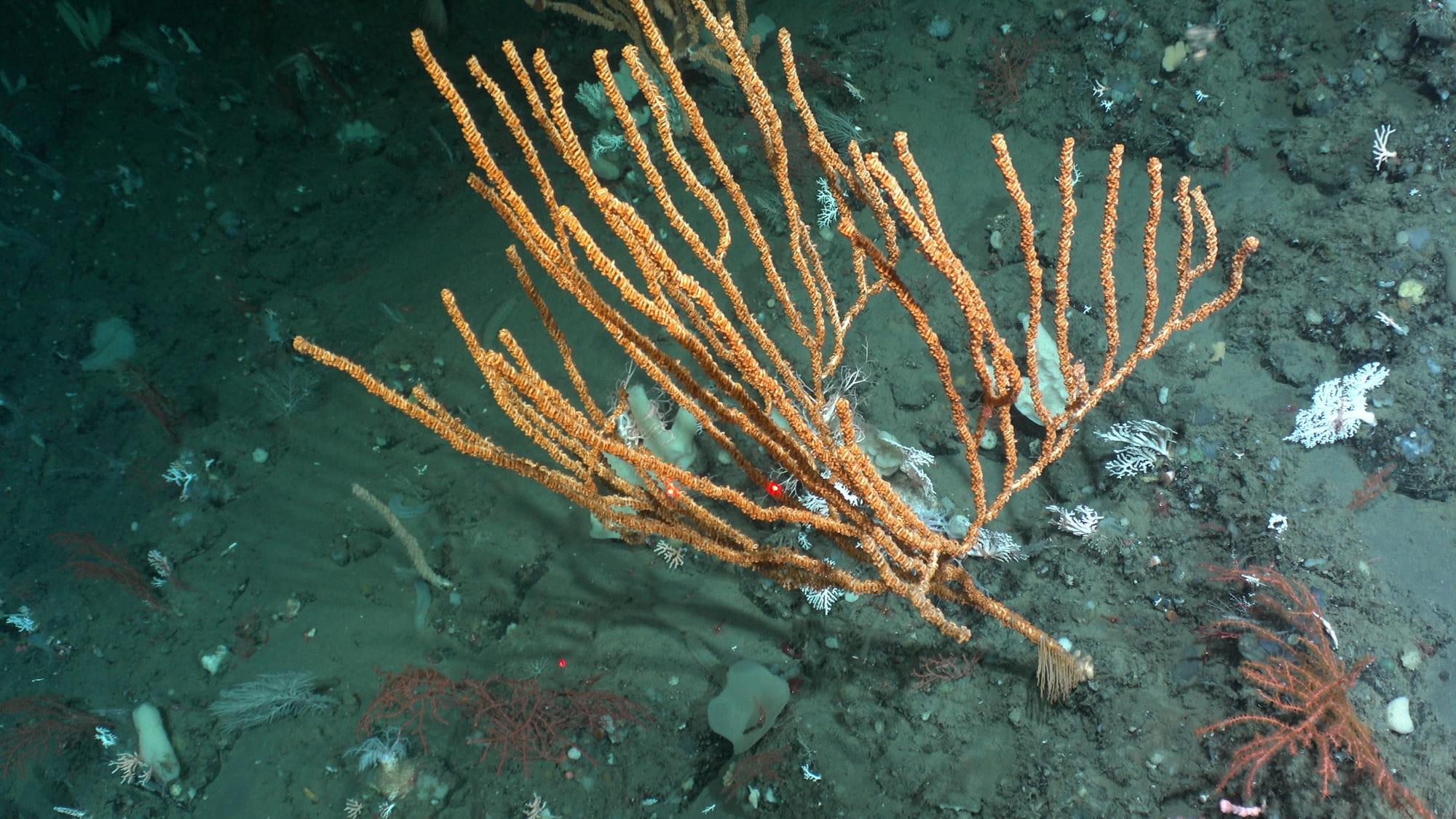
Researchers descended thousands of meters beneath the ocean surface in the U.S. Navy’s human-occupied vehicle Alvin. There, they investigated ecosystems shaped by volcanic activity, mineral seeps, and possible hydrothermal vents. The expedition built on earlier Saildrone Surveyor mapping missions that identified previously unknown seamounts and signs of hydrothermal activity.
Over 21 days, the team used advanced sonar systems, high-resolution cameras, and sampling tools to map the seafloor and collect biological and geological samples. These efforts produced new imagery and data from landscapes rarely seen by humans, helping fill major knowledge gaps about Alaska’s offshore environment.
Collaboration and Community
Led by the U.S. Geological Survey, the expedition brought together federal scientists, academic researchers, and partners from NOAA. BOEM experts Dr. Christina Bonsell and Dr. Shannon Cofield contributed their expertise, combining resources and technical capabilities to support the mission.
Beyond scientific discovery, the team connected with local communities through ship tours, public talks, and student programs. The Aleutian Arc study is expected to conclude in 2028, providing critical insights to guide future offshore decisions.
Studies Across America
The study is featured in BOEM’s new Studies Across America StoryMap, an interactive online narrative highlighting the bureau’s research and environmental assessment efforts, which BOEM launched to help commemorate America’s 250th birthday. Read more: Mapping the Aleutian Arc
For more information
- Seamount Benthic Mapping and Characterization, in support of Critical Minerals and Deep Corals of the Aleutian Islands
- Seafloor Benthic Mapping and Characterization: Enhancing our Understanding of Aleutian Islands’ Hazards, Potential Seabed Minerals and Deep Corals | U.S. Geological Survey
- Environmental Studies Information | Bureau of Ocean Energy Management
-- BOEM --
The Department of the Interior’s Bureau of Ocean Energy Management (BOEM) manages development of U.S. Outer Continental Shelf (OCS) energy, mineral, and geological resources in an environmentally and economically responsible way.