



Offshore Marine Cadastre (OMC) Navigator

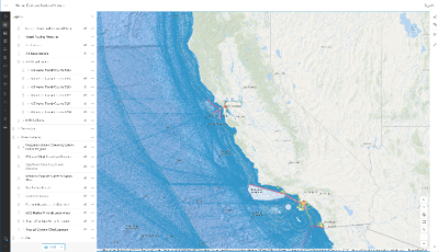
The Offshore Marine Cadastre (OMC) Navigator is a national viewer showing Protractions, Blocks, Aliquots, and Boundaries covering the Outer Continental Shelf (OCS). These are units of area measurement that officially describe the OCS and demarcate areas that could be leased for energy in accordance with 30 CFR 550.400, 30 CFR 585.205, and 30 CFR 581.15. The main purpose of the viewer is to provide PDF links to BOEM’s Official Mapping Products known as Official Protraction Diagram Index Maps, Official Protraction Diagrams (OPDs), Official Protraction Aliquots Diagrams (OPADs), and Supplemental Official Block Diagrams (SOBDs).
GIS Files
Please visit the Marine Cadastre Hub for an extensive list of ocean-related datasets. Marine Cadastre is a GIS data hub and online map viewer for displaying authoritative ocean geospatial information.
Below are some popular examples of some of the datasets you can find on the hub:
- OCS Planning Area Polygons
- OCS Withdrawal Areas
- Submerged Lands Act Boundary
- Offshore Oil and Gas Platforms
- Offshore Oil and Gas Wells
- AIS Vessel Traffic
Other Links
Planning Area Acreage Statistics
Legacy NAD83 Datum Transition Documents
- Part I: Responsibilities and Timeframes
- Part II: Technical Aspects of Implementation
- Summary Status Report
OPD Images
A standard OPD is 1 degree in latitude by 2 degrees in longitude (at lower latitudes: 0 - 48 degrees). At higher latitudes (48 - 75 degrees) such as Alaska and northern Washington, OPDs are 3 degrees wide. OPD limits usually approximate the standard 1:250,000 scale U.S. Geological Survey topographic map series. The OPDs are numbered using the United Nations International Map of the World Numbering System. OPD names usually coincide with standard topographic sheet names when diagrams include land areas. OPD sheet names relate to land features, or to hydrographic features contained within the limits of the diagram. Shoreline planimetric detail is shown when it falls within the limits of a diagram. Older OPDs were prepared on mylar with manual cartographic methods and then scanned into Adobe .pdf files. Newer OPDs were prepared electronically and converted to Adobe .pdf files.
NOTE: OPDs offshore of Oregon and Washington that show the Submerged Lands Act and Section 8(g) Zone boundaries do not reflect post-2010 shoreline changes. The Submerged Lands Act and 8(g) Zone boundaries offshore of California were permanently immobilized by the U.S. Supreme Court on December 15, 2014.
SOBD Images
A Supplemental Official OCS Block Diagram (SOBD) is prepared for each block intersected by an offshore boundary (Submerged Lands Act Boundary, Limit of "8(g) Zone", National Marine Sanctuaries, etc.). Note that not all OPDs contain such boundaries, therefore not all OPDs have SOBDs associated with them. All the SOBDs for a given OPD are zipped into a single file for downloading. The zip files will contain the most recent version, but older historic versions may also be included for reference. For the purpose of future Lease Sales always be sure to use the most recent version.
NOTE: SOBDs offshore of Oregon and Washington do not reflect post-2010 shoreline changes. The Submerged Lands Act and 8(g) Zone boundaries offshore of California were permanently immobilized by the U.S. Supreme Court on December 15, 2014.
CBD Images
Composite Block Diagrams (CBDs) show NAD 27 lease information portrayed on the NAD 83 cadastre. Not all OPDs have CBDs associated with them.