BOEM’s commitment to environmental stewardship includes research, impact assessment, interagency consultation, and stakeholder engagement.
The Marine Minerals Program funds state-of-the-art research to help inform our decisions and meet stewardship responsibilities. Please visit Research and Studies to learn more about the types of environmental research BOEM funds: biological studies, physical modeling studies, and environmental impact investigations.
We also analyze potential environmental impacts that could result from exploring for or using marine minerals located on the Outer Continental Shelf (OCS). BOEM prepares programmatic and project-specific environmental documents and undertakes related environmental consultations with other government agencies. Whenever possible, BOEM monitors and minimizes potential impacts that may occur on the OCS.
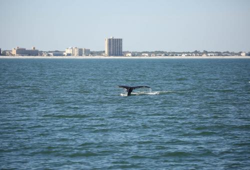
Whale fluke offshore
Duval County, Florida
(Florida Fish and Wildlife Commission)
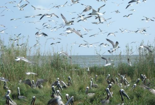
Pelican rookery along a Louisiana
barrier island
(BOEM)
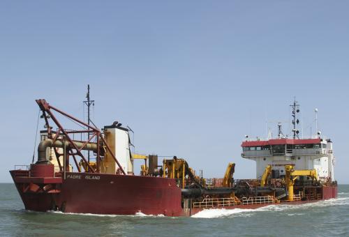
Hopper dredge under load
offshore Wallops Island, VA
(BOEM)
Environmental Laws, Regulations, and Executive Orders
BOEM complies with numerous environmental laws, regulations, and executive orders; some of the most relevant are:
- National Environmental Policy Act (NEPA)
- Clean Water Act (CWA)
- Coastal Zone Management Act (CZMA)
- Endangered Species Act (ESA)
- Magnuson-Stevens Fishery Conservation and Management Act (FCMA)
- National Historic Preservation Act (NHPA)
BOEM may serve as the lead federal agency in drafting environmental documents, or as a cooperating agency if another federal agency is serving as lead. We consult with federal and state agencies concerning potential impacts to endangered species and critical habitat, federally managed fish species and essential fish habitat, coastal effects, and historic properties.
BOEM applies the results of our environmental research to improve our environmental assessments and develop meaningful mitigation measures. We apply these mitigation measures to help avoid, minimize, or eliminate potentially adverse environmental impacts. We require monitoring, like protected species observers or pre-and-post bathymetric surveys, to evaluate impacts and design better mitigation measures.
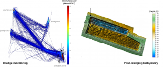
Dredge monitoring data for the Petit Bois borrow area used in the Mississippi Coastal Improvement Program. (Left) “Red” areas in the dredge position monitoring data show dredging and pump-out activities, whereas “blue” areas show transit of the hopper dredge out of the borrow area towards landward pump-out locations. (Right) Post-dredging bathymetry of the borrow area shows dredge furrows and a maximum seafloor depression of about 15 feet where OCS sand was dredged to restore Ship Island, part of the Gulf Islands National Seashore.
Environmental reviews are typically completed on a project-by-project basis and are available through our state project pages. Programmatic and regional environmental reviews and consultations are available on our regional page.